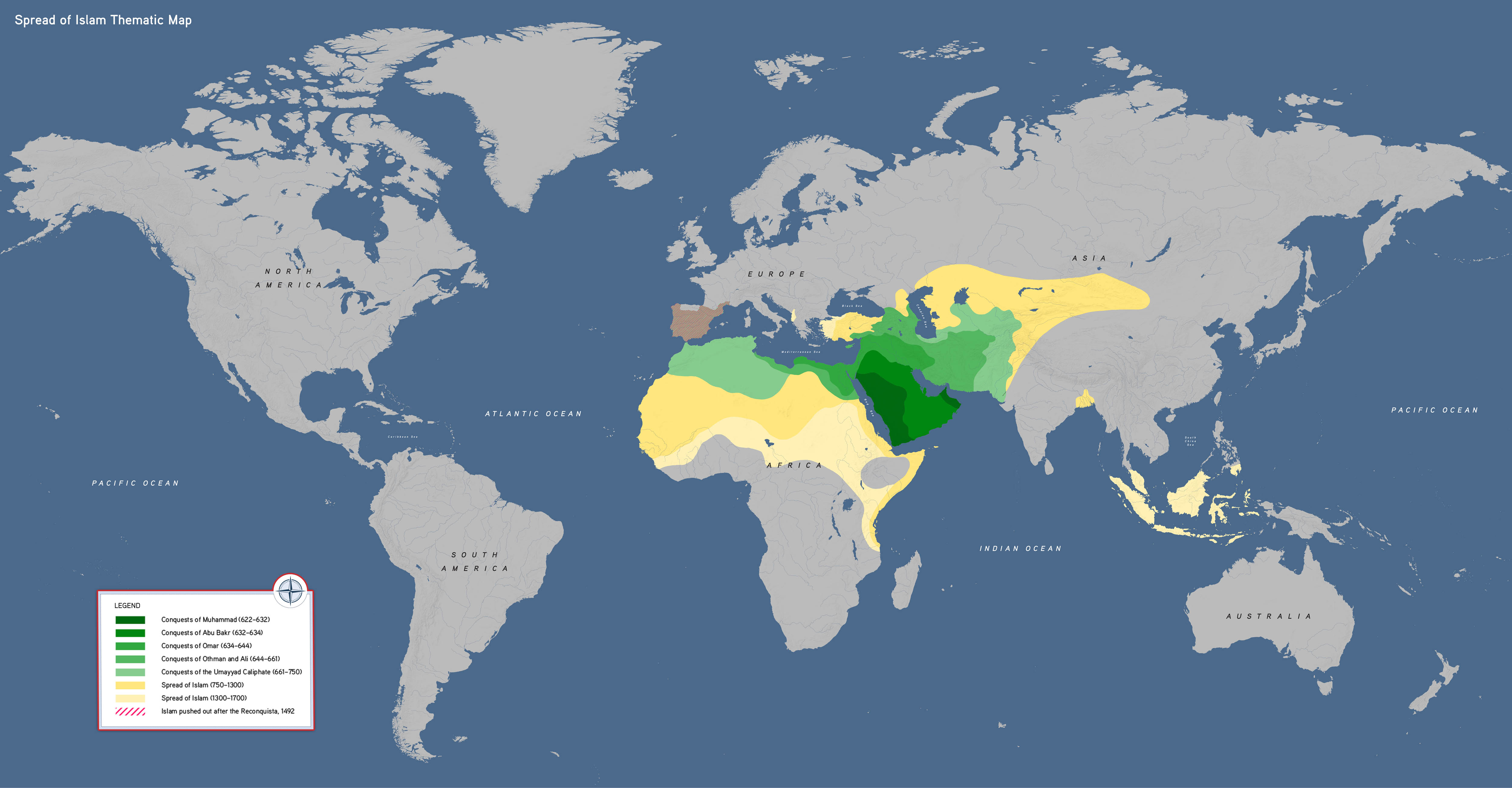

This thematic world map visualizes the expansion of Islam from 622 to 1700 CE. Students can use it to ask questions about motives for conversion, such as trade or literacy, and compare the spread of Islam to the political boundaries of the time.
This map highlights:
- The expansion of the Islamic faith
- Networks of trade, literacy, and cultural exchange
- Factors that facilitated or limited the spread of religion
Spread of Islam Map, by OER Project, CC BY 4.0.