
Empires, Enslavement, and Revolutions Thematic Map

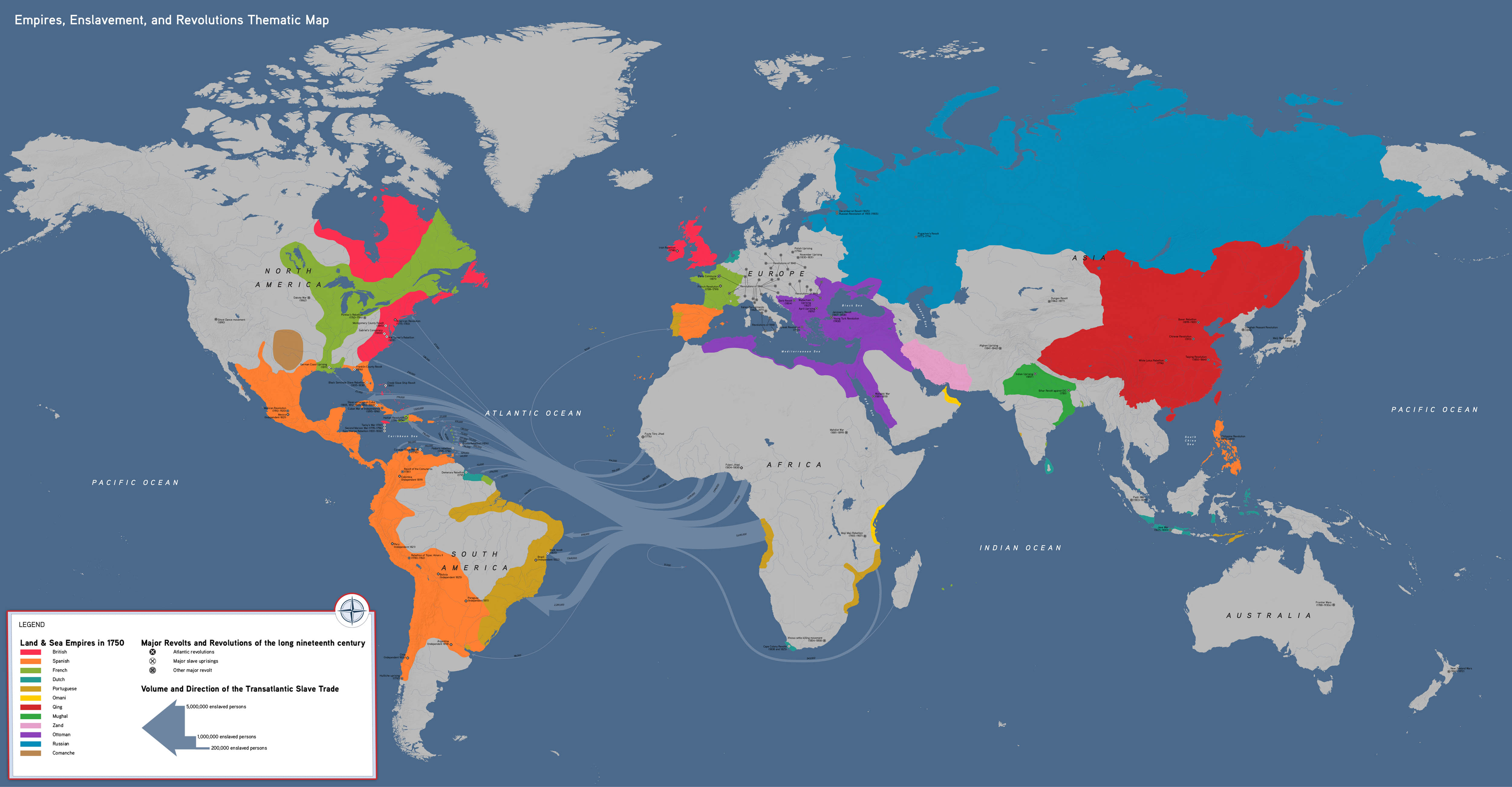

This thematic world map shows the world in the eighteenth and nineteenth centuries, connecting major global events that unfolded during this period. Students can use it to identify connections between major global trends like enslavement and the quest for political revolution.
This map highlights:
- The transatlantic slave trade and Atlantic Revolutions
- Connections between the American, Haitian, and French Revolutions
- Nationalism and the European Revolutions of 1848
- Large-scale uprisings in Asia (the Indian Uprising of 1857 and the Taiping Rebellion)
Empires, Enslavement, and Revolutions Map, by OER Project, CC BY 4.0.
Credit: Data on the volume and direction of the Transatlantic Slave Trade provided by Slave Voyages database. www.slavevoyages.org