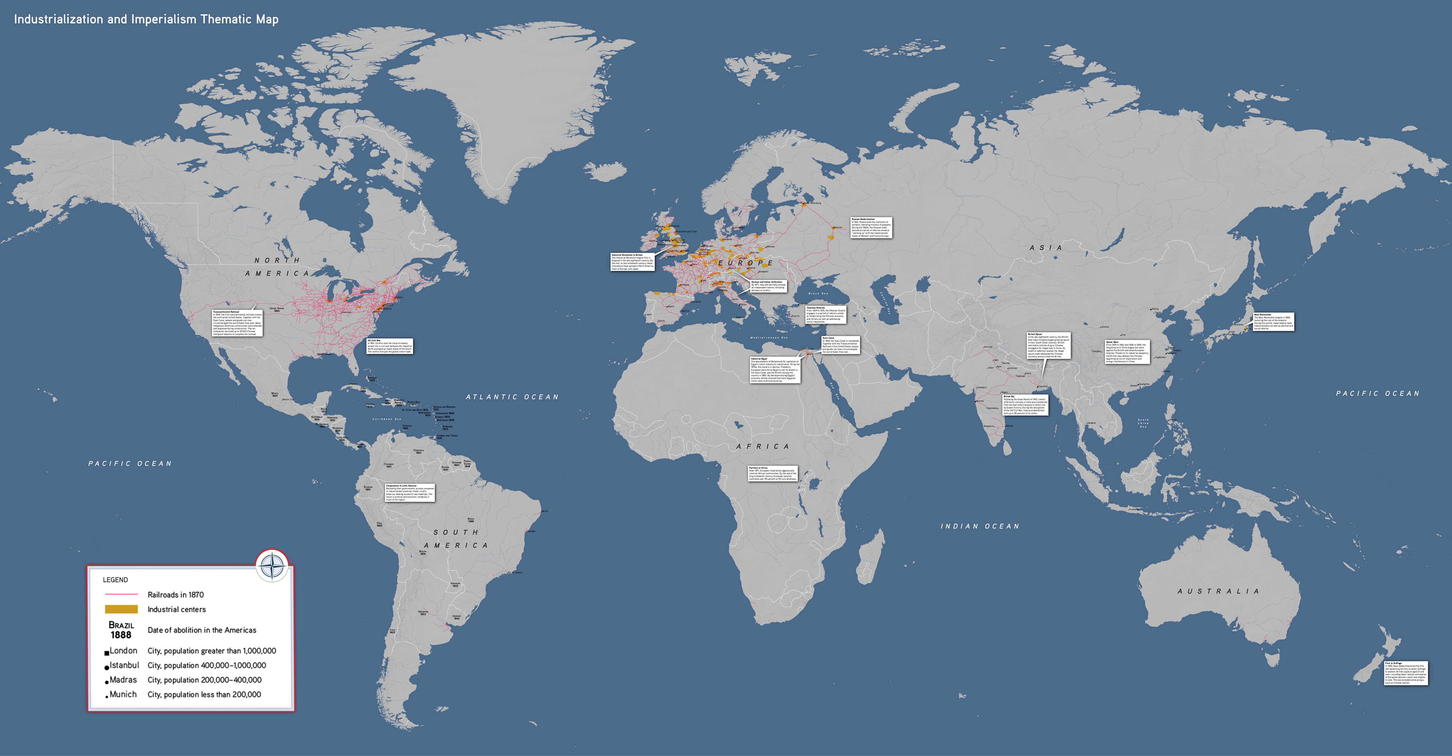

This thematic world map illustrates the effects of industrialization during the long nineteenth century, helping students visualize the connection between two major trends. Students can use the geography of railroads and urbanization in industrial centers to raise questions about the sweeping transformations of this period.
This map highlights:
- The geography of railroads and urbanization
- Imperial flashpoints across the globe
- The Industrial Revolution and its link to imperial expansion
Industrialization and Imperialism Map, by OER Project, CC BY 4.0.