
1750 CE Political Map

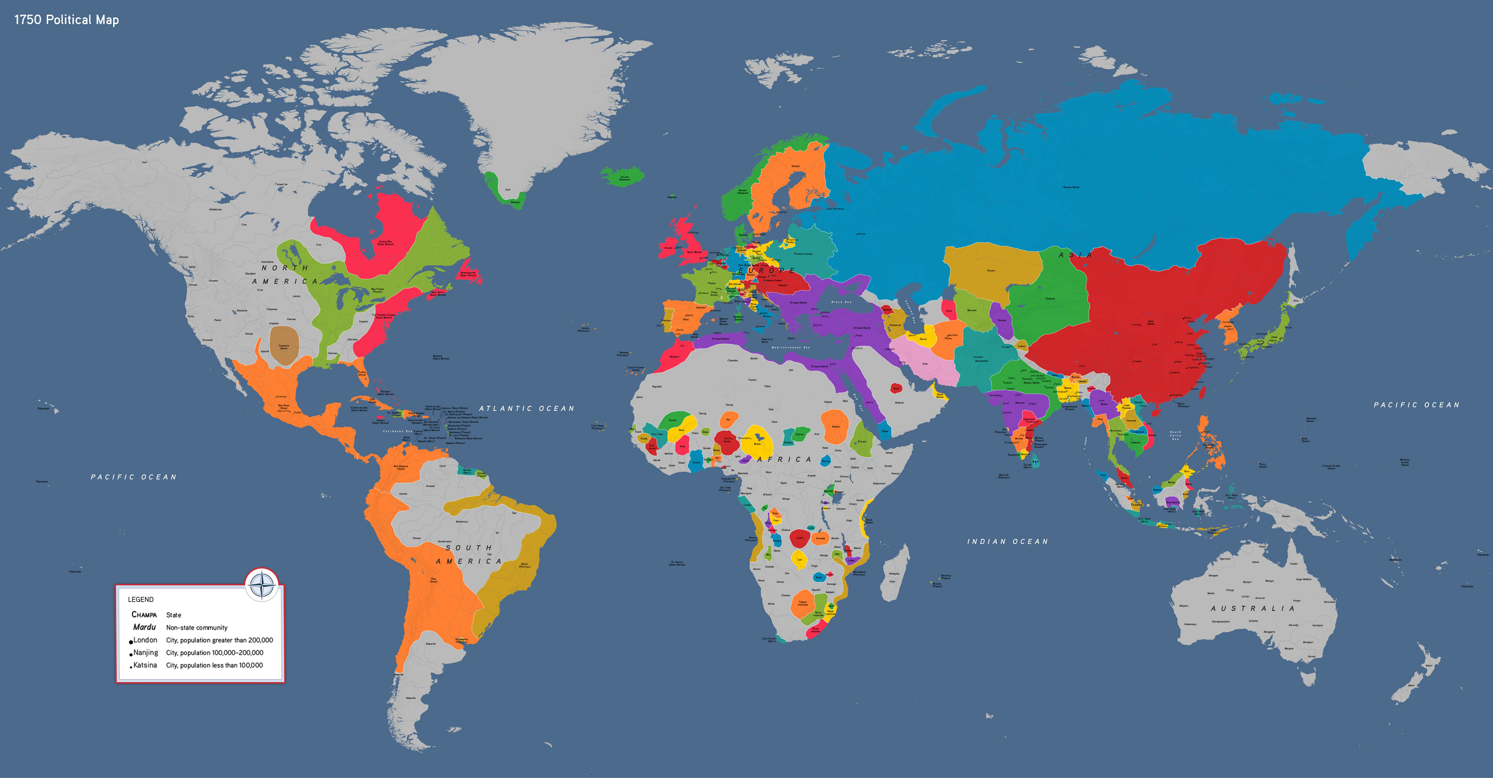

Our political world map of 1750 CE illustrates the growth and limits of major global empires
This map features:
- European colonies in the Americas
- The Russian Empire’s expansion and the massive Qing Dynasty
- The Ottoman Sultanate across three continents
- Independent societies and states in the Americas, sub-Saharan Africa
- Communities across Australia, New Zealand, and the Pacific
How to Use This Map
Students might use this map ass evidence to explore: What factors supported or constrained the growth of empire in the eighteenth century? What would happen when those limits were reached?
1750 CE political map, by OER Project, CC BY 4.0.