
1914 CE Political Map

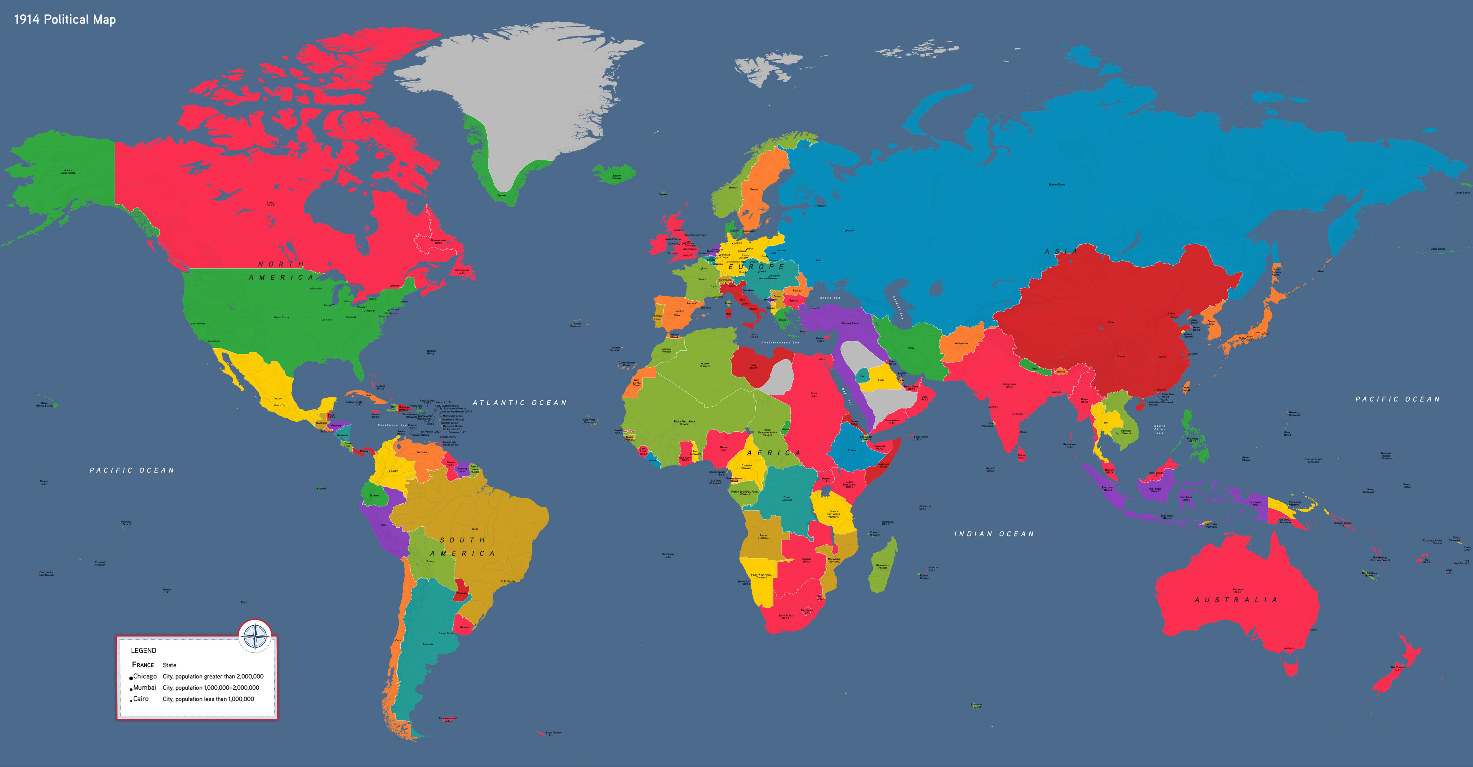

Our political world map showcases 1914 CE, visualizing a world transformed on the eve of World War I. Students can use the map to help understand the immediate origins of the conflict, including the challenges facing the Ottoman and Austro-Hungarian Empires and tensions in the Balkans. They can also orient themselves to flash points such as a rising Japan, European rivalries in Africa and the Middle East, and Russia's inability to access the Mediterranean. Startlingly, the map of the Americas in this period looks almost identical to today. Students might ask why so little seemed to change in this region of the world.
1914 CE political map, by OER Project, CC BY 4.0.