
100 CE Political Map

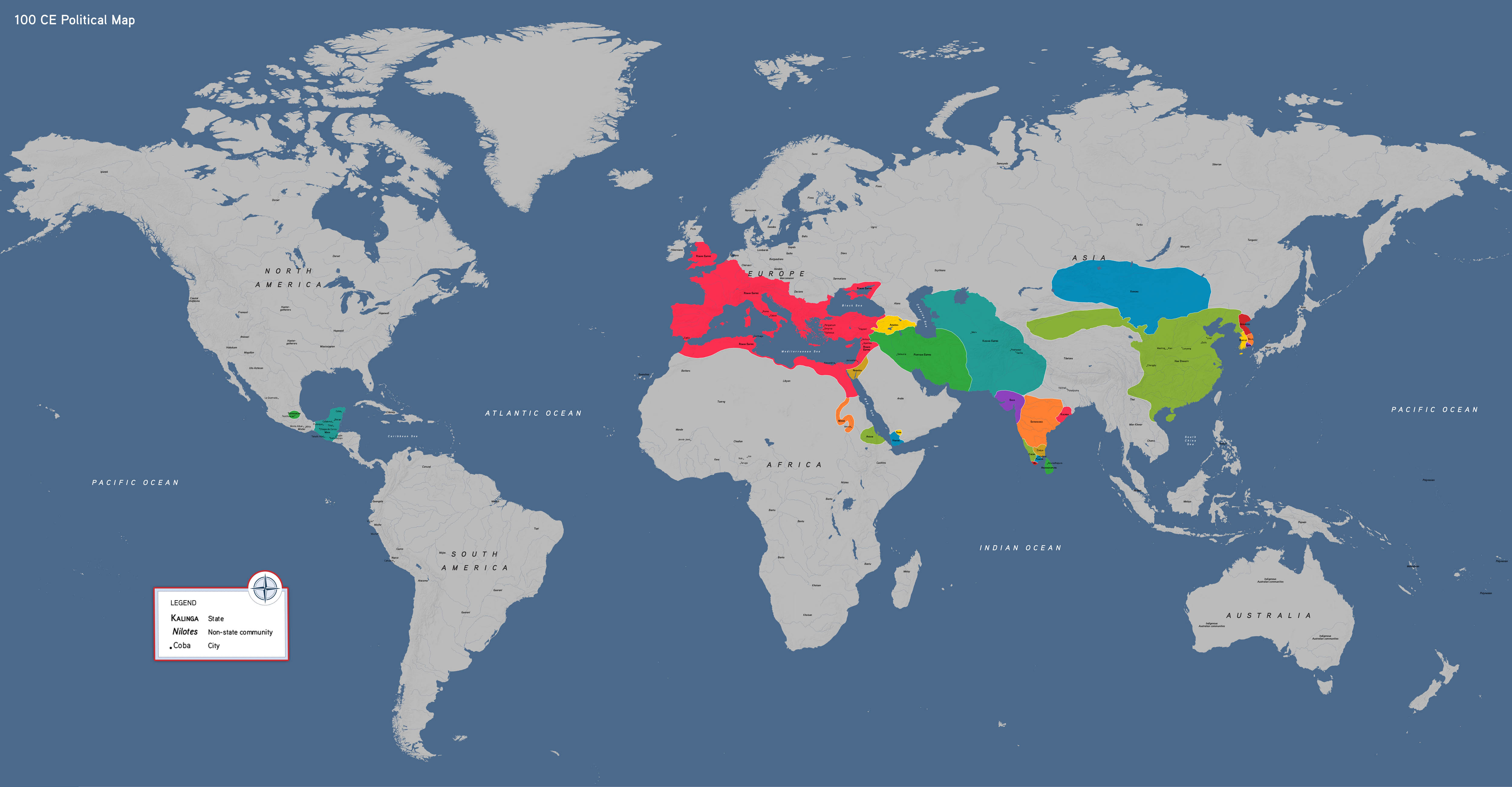

Our political world map showcases 100 CE, capturing the classical world at the height of its two great poles—Han Dynasty China and the Roman Empire. Between them stretched a wide array of African and Eurasian states.
This map features:
- The Roman Empire and Han Dynasty China
- The Kushan, Satavahana, and Parthian Empires
- The Xiongnu coalition of nomadic herders
- Regional powers (Chera and Chola in South Asia; Aksum and Meroe in Africa; and Armenia and Nabatea in Southwest Asia)
- Rising societies in the Americas (Teotihuacan and the Maya)
How to Use This Map
Students can use the map to investigate the geographic relationships between these interconnected societies. They might ask how trade, the spread of portable belief systems, and cultural exchange connected these communities.
100 CE political map, by OER Project, CC BY 4.0.