
1450 CE Political Map

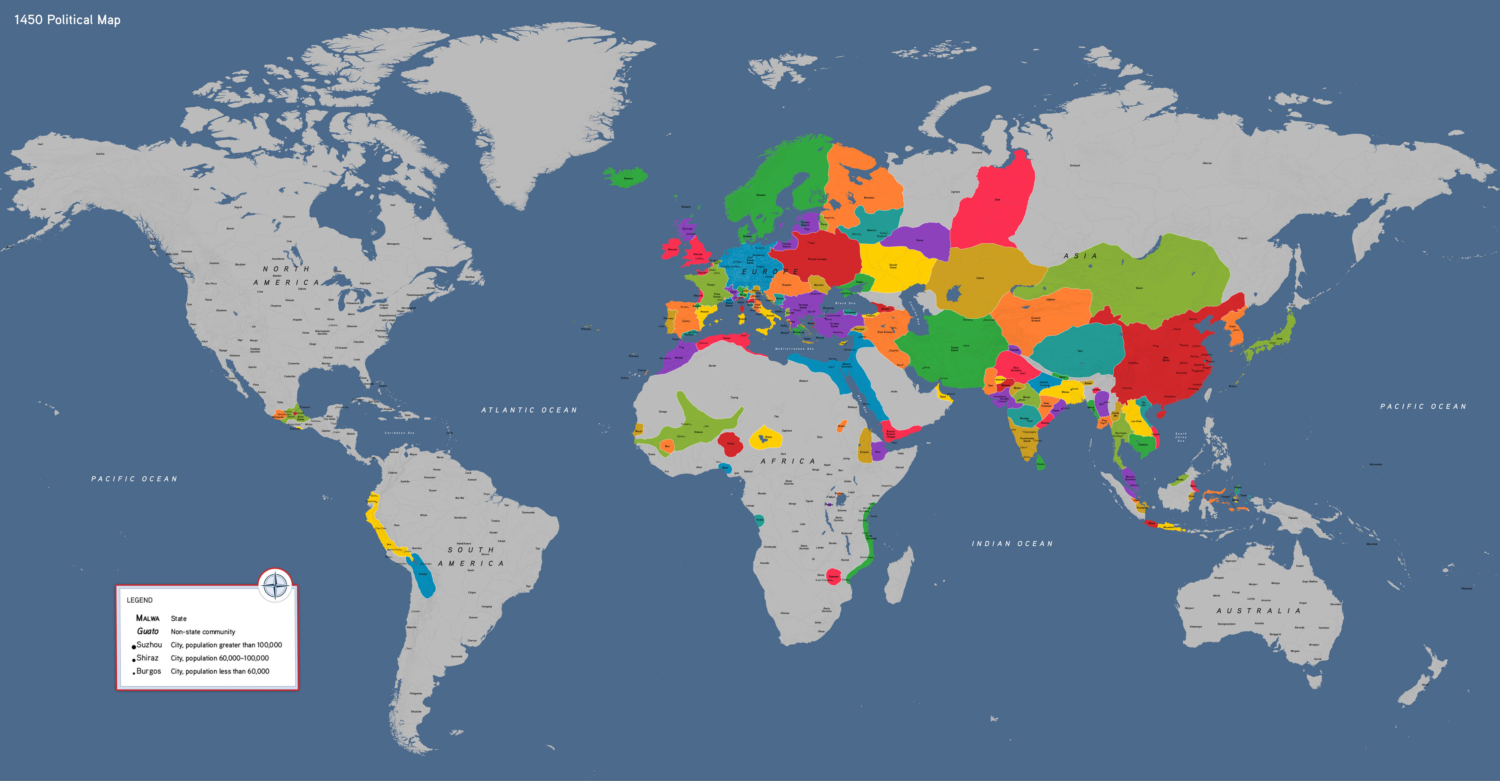

Our political world map showcases 1450 CE, highlighting an era of regional power and diversity following the breakup of Mongol hegemony. This map features:
- The Ming Dynasty and the Ottoman Empire
- Poland-Lithuania, Muscovy, and Dai Viet
- The Aztec and Inca Empires in the Americas
- The Songhai Empire and Mamluk Egypt
How to Use This Map
Students can use this map to compare how different regions developed after the decline of Mongol rule, considering how political fragmentation, trade networks, and local conditions shaped distinct paths across Afro-Eurasia. In the Americas, it illustrates the dramatic rise of empires embedded in a network of rivals and trading partners.
1450 CE political map, by OER Project, CC BY 4.0.